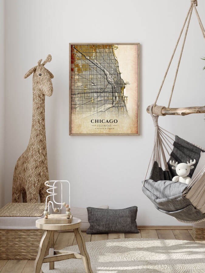
Do you ever wonder what this famous town looked like long ago? Even though it has grown and changed a lot over the years, this Antique Chicago Map Poster displays the ever present charm of the city and will surely convey it to your home.
This Antique Chicago Map Poster belongs to our collection of Antique City Maps. The collection brings the feeling of a bygone time and serves as a reminder of vintage printing methods.
For example, in the past people created city maps with printing methods specific to their period of time, and they are rare in the production of today’s maps. Those methods include carving and engraving. The outcome of this work was one or several prints of the same map. With today’s printing methods we can have many copies of the same map, making it available to a larger number of people who enjoy this kind of art.
Poster of Chicago antique city map
Why Should You Own the Chicago Map?
Chicago is the biggest city in Illinois and the third-largest city in the United States. When you observe the Chicago Map, you can see that the city’s streets are arranged in a way in which they run at each other at right angles. This type of city planning is called a street grid or grid plan.
Besides this structured part, there are several diagonal streets, which have their origins in the Native American trails. All of these streets are on our map, so feel free to explore them in more depth.
Decorate Your Home With Our Vintage Chicago Maps
When choosing which poster you like the most and before starting your purchase, there are some extra features that we would like to share with you:
To begin with, we use archival pigment on museum-quality paper for our posters.
There are several dimensions of the posters to choose from. Precisely, they come in the following sizes: 12×16″, 18×24″, and 30×40″.
Before shipping, we cautiously pack the selected print into the poster tube with archival-quality glassine paper.
As demonstrated, the satisfaction of all the customers and the safe delivery of the products are our top priorities.