Blueprint & Antique City Maps Collection
Are you the type of person who loves looking at maps and trying to find your way around new or unknown places? Do you find beauty in the way our Earth looks from above with its natural shapes and manmade additions? If so, I have just the thing for you, our Blueprint & Antique City Maps Collection.
I am proud to officially announce that we are releasing two new collections featuring maps of United States cities. These two featured artworks are the Antique City Maps collection and the Blueprint Maps collection. They both cover the same 60 US cities but differentiate in the style of the map. As you might have guessed, the blueprint city maps are made in the style of industrial blueprints. The antique city maps feature a more vintage look, like the maps you might see in a museum. Both of these styles are for sale in our shop right now!
Vintage City Maps
These aerial prints look like antique map reproductions. The collection includes 60 US city maps. I love the style of old vintage city maps often seen in museums and I always wanted to have one. That is why it was a no-brainer to create a collection of these. They are an ideal and affordable gift for anyone that loves maps and history, and even more so if they have a particular interest in one of the cities. It was difficult to choose which 3 cities from our collection to show here.
The most important thing is that all of them are of the same high quality as those shown below. So, visit our Antique City Maps collection and look for your city there!
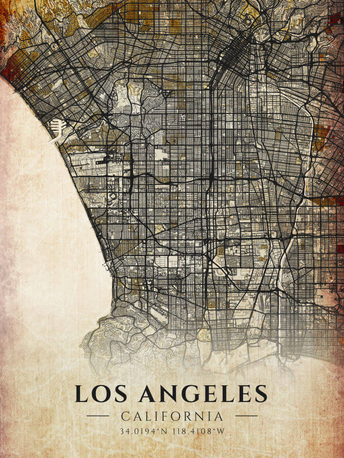
Antique Map Los Angeles
Los Angeles, the City of Angles, was one of the first cities we decided to add to our collection. It is the world capital of the entertainment industry. Many movie stars, musicians, artists, and even Youtubers call Los Angeles their home. People from all over the world are familiar with the city in some way and may wish to own a personal map. What we show here is the antique Los Angeles map, suitable to a city with such a diverse and exuberant history.
As the metropolitan area of LA is huge, not all of it is displayed on the map. But famous areas such as downtown, Hollywood, Santa Monica, and others are included. If you are a fan of LA, you will enjoy our vintage map of Los Angeles.
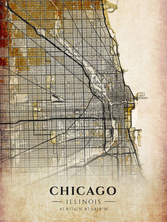
Vintage Chicago Maps
Chicago is another great American city famous worldwide for movies, television shows, songs, and sports teams. Who hasn’t heard of Michael Jordan and the Chicago Bulls, right? This city grew from a small trading outpost to America’s third largest city. It is known for its famous skyline, a multitude of tourist attractions and a vibrant nightlife. Some folks refer to Chicago as “the nation’s industrial crossroads” because it is where many of our rail transportation networks converge. Other’s may know Chicago as “the windy city” referring to it’s blistering winters.
This map was designed in a style reminiscent of vintage maps of Chicago, but it features the modern layout of the city.
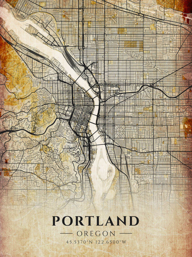
Antique Maps Portland Oregon
Portland is one of the more unique cities in the USA and that is why we included it here. Located in the Pacific Northwest, it is second only to Seattle in population. Portland is known for its vibrant cultural scene and an array of counterculture and progressive views. No wonder it is a special place for many. This Portland city limits map has been designed in a vintage style and looks even better in person. If you are interested in our Antique Map of Portland, Oregon, or you know someone who would love to get it as a gift, hop over to our shop and get it today!
Blueprint Maps of US Cities
This collection includes 60 blueprint city maps of United States cities. I always find the look of blueprints fascinating; the white lines on a blue background look so sharp and clean. I knew I wanted to design a poster that incorporated that style in one way or another, and it came to me when we were designing the antique city maps you saw above. Create the same maps of famous US cities in a blueprint style.
I love the final look of these blueprint city maps and I am proud to present them to you today. Here are a few selected examples so that you know what to expect. If you want to find your own city, visit the Blueprint City Maps collection in our shop.
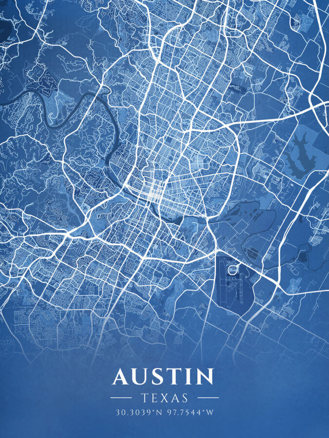
Street Map Austin, TX
Austin, capital of the great state of Texas, was a city I wanted to include from the start. Over the years, more and more people have been migrating to this desirable city. Relatively safe for its size and with an interesting cultural scene, it’s no wonder people love it. Austin has been described as “an outdoor enthusiast’s playground,” offering hiking, biking, and boating in crystal clear lakes. If you want to own a blueprint map of Austin, here is a perfect opportunity. It will be a visual magnet for your living space or a great gift for someone who loves this city!
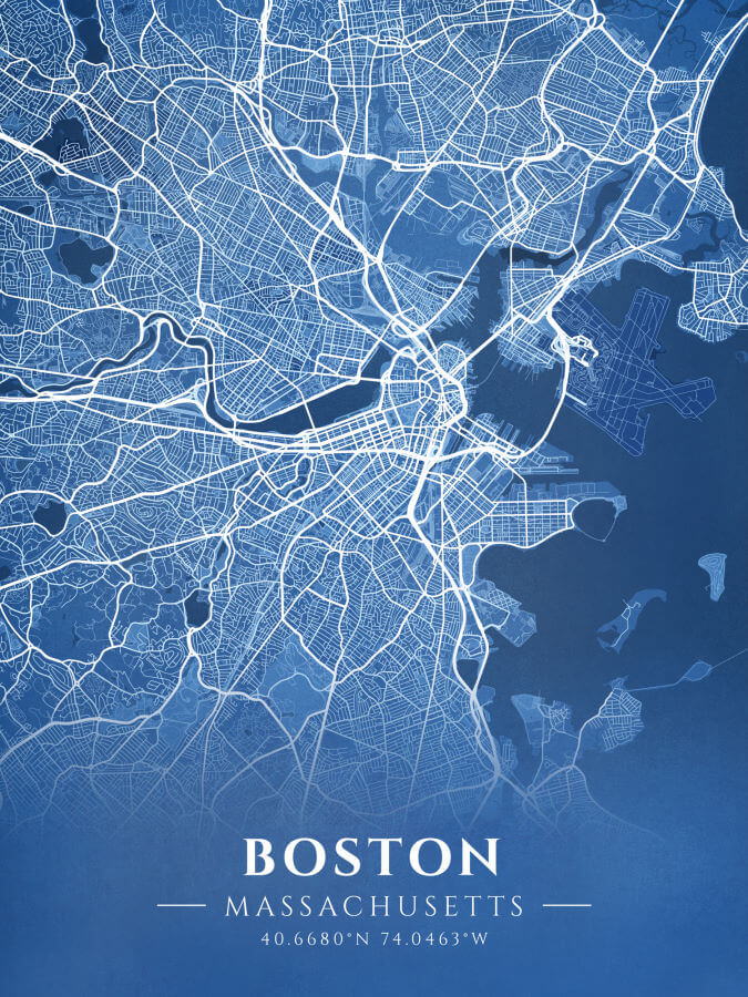
Boston City Map
Boston is a city with a rich and proud history. It was a simple choice to include it on our list and make a city of Boston map. Apart from its history, the city is known worldwide for its legacy of arts, culture, sports teams, and its many universities. Most famous is Harvard University and MIT: the Massachusetts Institute of Technology. Many people all over the world dream of studying here. If you were looking for a reason to get a Boston map, here it is! Get our street map of Boston from our Blueprint city maps collection and display your love for this city!
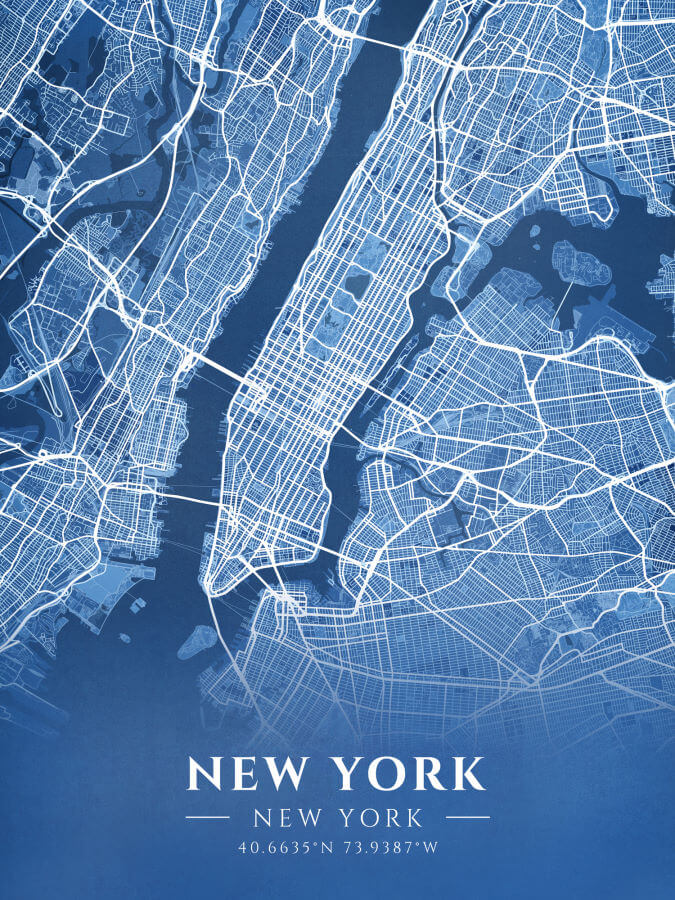
New York City Street Map
Last, but definitely not least, we have the most famous city in the world, New York City. Known as “The Big Apple” New York City has many ports and has been welcoming Europeans and others into the country since the earliest colonies settled there with the Lenape Indians. New York is the largest city in the Western hemisphere. Of its population of 8 million, one third of these were born outside of the United States. NYC is considered the cultural capital of the US.
If you’d like to own a modern blueprint style New York City street map, you are in the right place. Visit our store and get it now! We also have antique New York City maps for sale there!

- The US Islands Map Posters Collection - October 11, 2023
- LGBTQ Maps Collection – Maps of Love - September 18, 2023
- Why We Love Map Posters - August 30, 2023